


Our final full day in New Zealand, we spent most of the day driving up into Lindis Pass for a picnic lunch. Lindis Pass (Omaka) is actually near Geordie Hill Station where FlyInnNZ is based, lying between the towns of Cromwell in Central Otago and Omarama in North Otago on the main route to the Waitaki Basin in the Otago Region. The pass is the highest point in the state highway system of the South Island at elevation 971m. It is not considered an alpine pass because it is in the dry grassland area in the rain shadow of the Southern Alps.
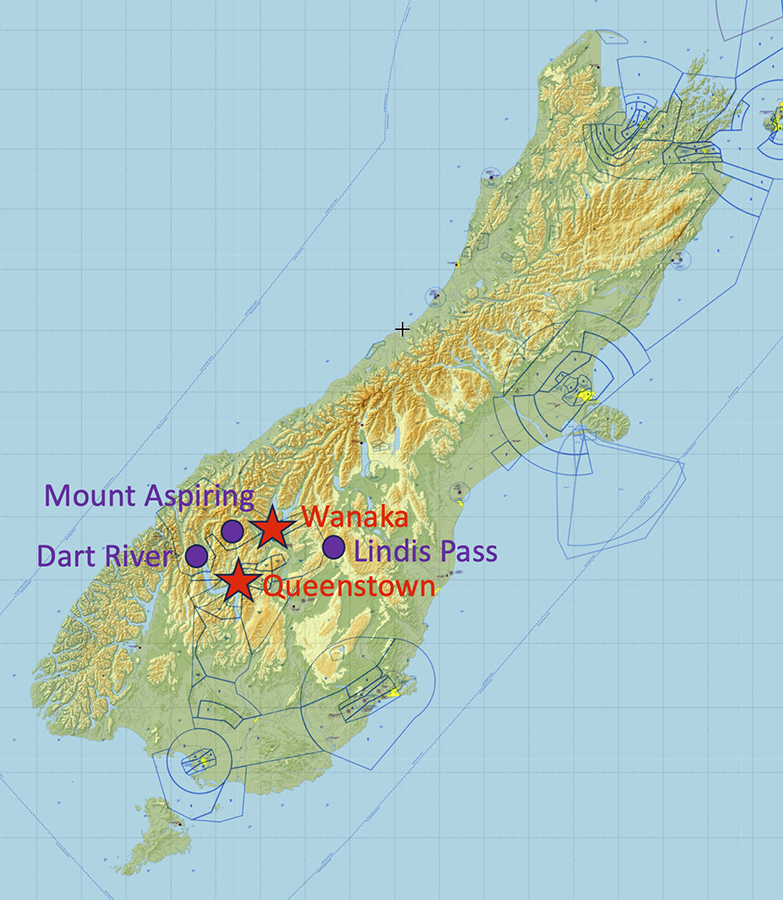
Late in the afternoon, we flew from Wanaka, NZWF, via Mount Aspiring and the Dart River back to Queenstown, NZQN, wth Matt. Mount Aspiring is New Zealand's 23rd highest mountain, 3033m, and the highest mountain outside of the Aoraki/Mt. Cook region. It is 30km west of Lake Wanaka. The Dart River (Te Awa Whakatipu) flows southwest and then south from its headwaters at the Dart Glacier in the Southern Alps into the northern end of Lake Wakatipu near Glenorchy. The plane I had been flying, ZK-WAX, was now down for its hundred-hour inspection and was in the maintenance hangar, so I flew the other one, ZK-TRS. It started out as a 1976 C172N with a 180hp engine conversion, so it is bit newer than ZK-WAX and has a somehat fancier VFR avionics panel. Queenstown is a towered field with lots of small-to-medium-sized jet traffic. To get in there from the north you follow south along the western shore of Lake Wakatipu, staying over the land side of the shoreline, which can be a bit intimidating due to the very steep slope of the terrain west of the lake. We got beautiful views of The Remarkables (Kawarau) mountain range on our way in.


Mount Aspiring:


©2025 Mermaid Underwater Photographic. All Rights Reserved.
This page sponsored by Mermaid Underwater Photographic. Contact us at mermaid@underwater.org.
Last modified 2 April 2025